Olifants River Vegetation Survey

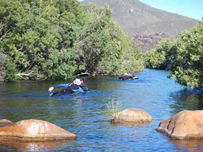
The New Year started with a splash for PCU staff member Sam Jack, PCU MSc graduand and expert botanist Greg Nicolson, and UCT Department of Statistical Sciences Assoc. Prof. Ian Durbach. The hot early January weather saw the intrepid trio take to the cooling waters of the Olifants River in the Agter-Witzenberg Valley. The goal was to conduct a basic vegetation survey from the top of the catchment at Visgat, to the farm Keerom on the plains south of Citrusdal. It took five days for the three to complete their journey, hiking, rock-hopping, wading and swimming their way downriver, aided by lilos specially reinforced with a tough fabric lining to withstand the hazards of river travel.

Paddling down the Olifants River on a research expedition is a sensible way to be productive in the January heat. Photo credit: Greg Nicolson
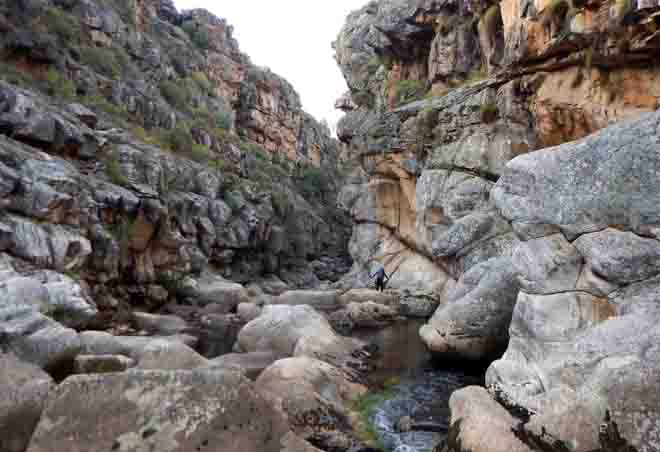
Much of the upper Olifants is characterised by dramatically deep and dark slot canyons carved into the bedrock which were sometimes only as wide as the lilos on which the team travelled. Eroded potholes visible several metres overhead bore (excuse the pun) testament to the perpetual steady erosive force of water (and the occasional flood event), which has carved these beautiful natural features. Further downriver the canyon opens to display a wealth of indigenous riverine vegetation and fynbos, battling it out in the sweltering January weather. All the while the river continues to flow lazily northwards, transporting the researchers ever so slowly downriver.

Sam dwarfed by cliffs formed by down cutting of the river channel through bedrock. The rounded surface of an eroded pothole can be seen directly above him. Photo credit: Greg Nicolson
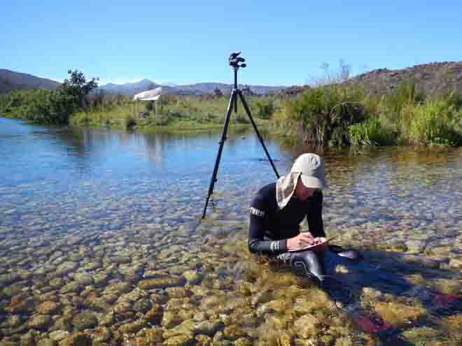
The Olifants River vegetation survey follows a similar study conducted by Sam and Greg in early 2015 on the smaller Twenty-four Rivers within the Groot Winterhoek Wilderness Area (read summary here). This study updated our knowledge of the condition of the riverine vegetation and presence of alien species in the Twenty-four Rivers system. The aim of the Olifants River vegetation survey was similar, the primary goal being to establish a 2016 baseline photographic record of vegetation within the channel at regular intervals of 1 km. Information on the dominant woody riverine species and palmiet (Prionium serratum) abundance were recorded at the same interval. Alien vegetation, particularly black wattle (Acacia mearnsii), is an ongoing problem in parts of the Olifants catchment, which meant that assessments of alien abundance and stage class was carried out on a more regular interval of 500 m.

Sam keeping cool while recording data on indigenous woody species abundance in the lower catchment. Establishing repeat photo stations in this part of the river can be tricky as large boulders on which to place the tripod are absent. Photo credit: Greg Nicolson
The findings of the Olifants River vegetation survey have been compiled into a brief report which can be found at the following URL: PCU Professional Reports. The team wishes to extend their thanks to landowners, particularly Murray Bridgeman and to Timm Hoffman, Director of the PCU, who helped make the trip possible.
Article by Sam Jack
