Mapping the fire on Table Mountain that destroyed the Plant Conservation Unit

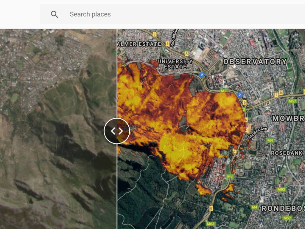
Research associate Dr Zander Venter, who is currently based in Norway, has developed a sliding tool using Google Earth Engine to visualise the extent of the uncontrolled Table Mountain fire that began on 18 April 2021. The map uses satellite imagery to map the burn scar (area) and the fire intensity over the affected area, which was approximately 6 km2.
Zooming into the map one can fully appreciate how the fire encroached on urban areas and destroyed buildings, including the Plant Conservation Unit in the HW Pearson building at UCT (see this article for the extent of damage to the Plant Conservation Unit).
Mapping tools such as these are important for assessing the extent and severity of uncontrolled fires, and will be instrumental in future environmental planning.
